Crystal Lake Trail Swan Valley: Complete Hiking Guide
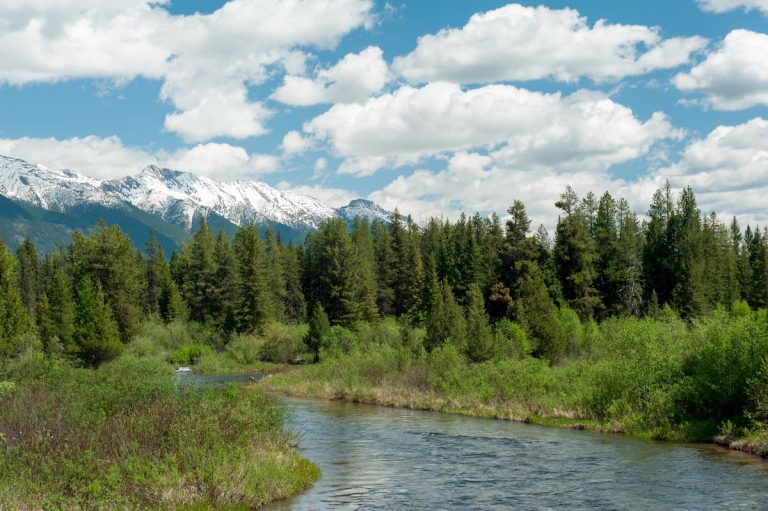
Crystal Lake Trail offers a unique hiking experience in the Mission Mountains Wilderness, descending 1,000 feet over 2.3 miles to reach a pristine alpine lake surrounded by old-growth forest. Located north of Condon, Montana in Swan Valley, this moderately difficult trail provides access to one of the Mission Mountains’ most accessible wilderness lakes with opportunities for swimming, fishing, and backcountry exploration.
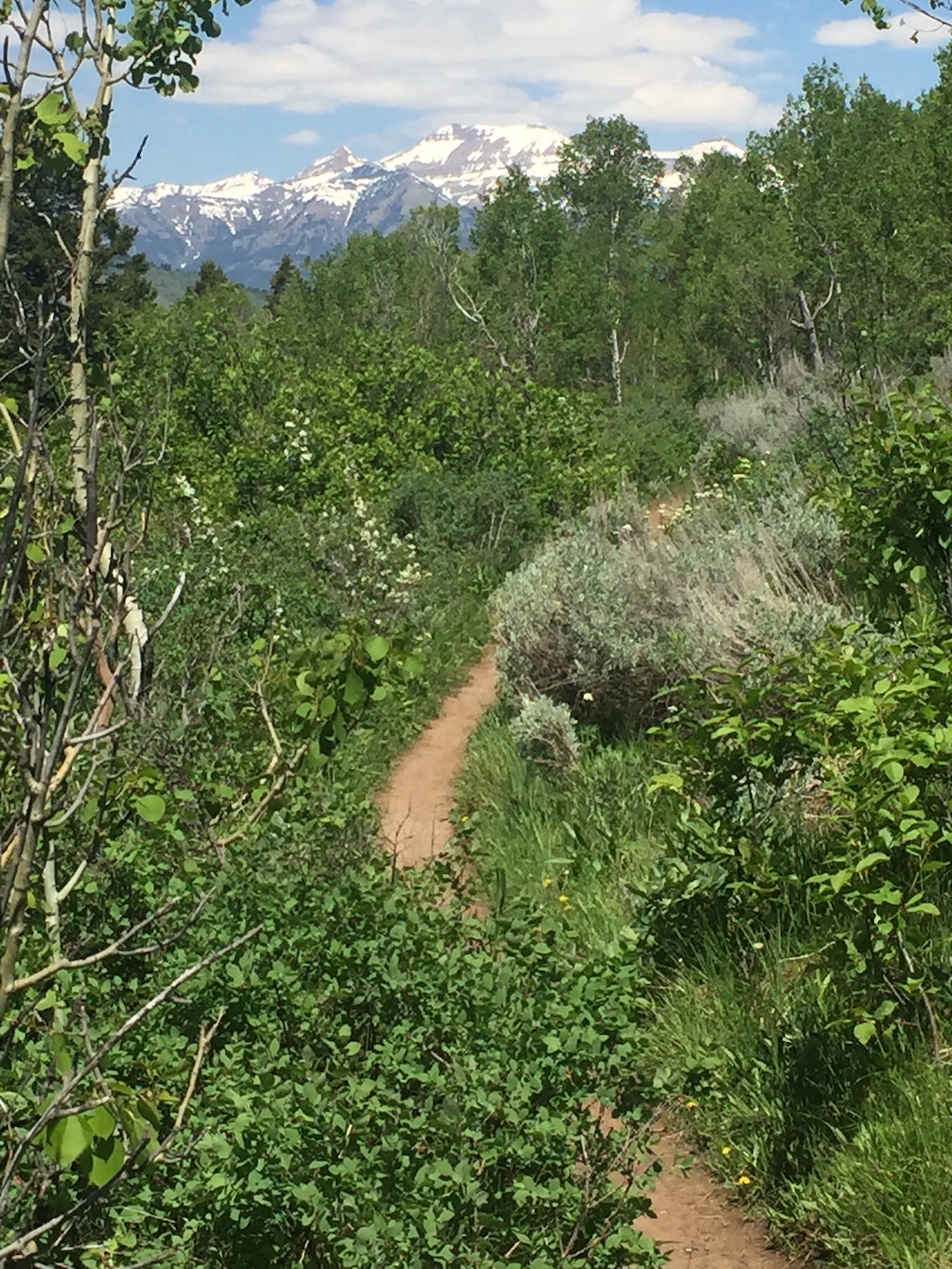
The trail winds through stands of massive ponderosa pine and western larch, crosses meadows filled with beargrass and huckleberries, and delivers hikers to a rocky shoreline beneath towering peaks. Unlike most mountain lake hikes that require steep climbs to reach the destination, Crystal Lake Trail descends first, saving the challenging uphill section for the return journey when packs are lighter.
Three separate routes access Crystal Lake, with the north trail providing the shortest and most direct approach. The trail receives heavy use during summer months, particularly on weekends, reflecting its popularity among both day hikers and backpackers exploring the Mission Mountains Wilderness.
How to Get to Crystal Lake Trailhead
The Crystal Lake North Trailhead is located approximately 18 miles from Condon, Montana via Highway 83 and Lindbergh Lake Road. From Condon, drive north on Highway 83 for approximately 4 miles to mile marker 35. Turn west onto Lindbergh Lake Road (Forest Road 79).
After 3 miles on Lindbergh Lake Road, bear right at the junction following signs for FR 79 and Lindbergh Lake Campground. Continue 0.6 miles from this junction and turn right following signs for Trailheads/Bunyan. The trailhead is located at the end of the road, 7.4 miles from this turn, for a total of 11 miles from Highway 83.
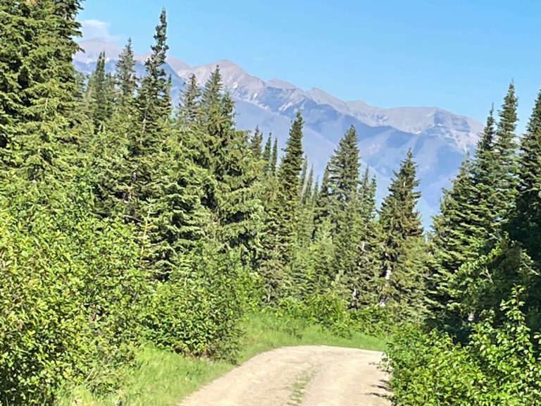
The final miles of Forest Road 79 are maintained gravel requiring normal clearance vehicles in dry conditions. Wet weather or early season travel may create muddy sections. The road passes through national forest land with views of Lindbergh Lake to the south.
Parking at the trailhead accommodates approximately 6-8 vehicles. Arrive early during peak season weekends to secure parking. The trailhead features an information kiosk but no other facilities. No toilets or water are available.
From Missoula, the drive takes approximately 1.2 hours covering roughly 85 miles. Take Highway 83 north through Seeley Lake and continue into Swan Valley. From Kalispell, allow 2.5 hours for the 100-mile drive south on Highway 83.
Cell phone service is unreliable throughout this area. Download maps and directions before departure. The nearest gas and supplies are in Condon, 18 miles from the trailhead.
Trail Description and Difficulty
Crystal Lake North Trail (#351) covers 2.3 miles one-way, descending 1,000 vertical feet from trailhead to lake. The elevation loss creates a moderate to difficult rating depending on fitness level and experience with steep terrain.
The trail begins relatively flat for the first half mile, winding through mixed conifer forest. After entering the Mission Mountains Wilderness boundary, the grade steepens considerably. Multiple sections feature sustained steep descents requiring careful footing, particularly when wet or covered with pine needles.
Old-growth ponderosa pine and western larch dominate the forest canopy. Some of the largest western larch trees in the Mission Mountains Wilderness grow along this trail, with diameters exceeding 4 feet. The south-facing aspect supports diverse vegetation including huckleberry bushes, beargrass, and wildflowers during summer months.
The trail crosses several small streams and marshy areas, particularly in early season. Water flow diminishes by late summer. Log footbridges span some crossings, though sections may require stepping across rocks or walking through shallow water.
Wildlife sign is common. Black bears and grizzly bears inhabit the area. Elk and white-tailed deer frequent the drainage. Evidence of mountain goats appears on upper slopes visible from the trail.
The final quarter mile to the lake levels out, reaching the north shore at approximately 5,100 feet elevation. The trailhead sits at 6,100 feet, creating the 1,000-foot descent.
What to Expect at Crystal Lake
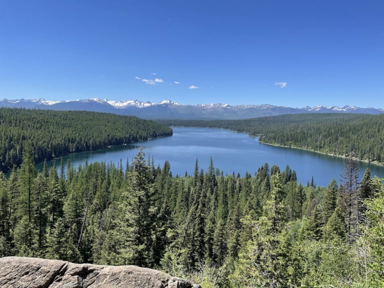
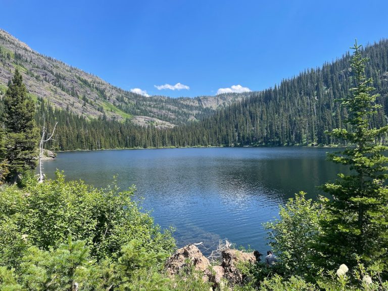
Crystal Lake occupies a glacially carved basin at the head of the Crystal Creek drainage. The lake covers approximately 25 acres with depths reaching over 50 feet in areas. Clear, cold water maintains temperatures between 50-60 degrees Fahrenheit even in summer.
Rocky beaches line portions of the shoreline, particularly on the north end where the trail arrives. These beaches provide access for swimming and fishing. The lake’s gradual drop-off near the north shore makes it more accessible for wading compared to many alpine lakes.
A dramatic sheeting waterfall covers much of the cliff face at the lake’s western end. Glacial runoff creates this feature, which flows strongest during spring snowmelt and diminishes through summer. Small islands of trees grow where the outlet stream flows from the lake, creating a scenic foreground for photographs.
Views from the lakeshore extend west toward the Mission Mountains crest. Peaks visible from the lake include Goat Mountain, Sugarloaf Mountain, High Park Peak, and Sunset Peak, all exceeding 8,000 feet elevation.
Fishing targets brook trout, which were historically stocked in the lake. Natural reproduction maintains the population. Standard Montana fishing regulations apply, requiring appropriate licenses. Fishing pressure is moderate to heavy during summer months.
Camping is permitted throughout the Mission Mountains Wilderness, though regulations restrict camping within 200 feet of water sources in some areas. Established campsites exist on the north shore. Leave No Trace principles apply to all camping activities.
Alternative Routes to Crystal Lake
Two additional trails access Crystal Lake, offering different experiences and difficulty levels.
South Trail #351
The Crystal Lake South Trail covers 4.4 miles one-way with approximately 500 feet of elevation loss. This longer but gentler route begins at Beaver Creek Road (Forest Road 906), accessed from Highway 83 near mile marker 31.
To reach the south trailhead, turn west onto Beaver Creek Road just before the cell phone turnout with the Lolo National Forest sign. Continue 7.4 miles to the trailhead on the right side of the road.
The south trail provides a more gradual descent and ascent, making it preferred by some hikers despite the longer distance. The route sees lighter use than the north trail.
Lindbergh Trail #490
The Lindbergh Trail requires boat access across Lindbergh Lake, followed by a 2.8-mile hike. Boaters travel 4 miles to the southern end of Lindbergh Lake to reach the trailhead.
To access Lindbergh Lake boat launch, follow Lindbergh Lake Road (FR 79) for 3.6 miles from Highway 83, staying straight at the junction instead of bearing right toward the Crystal Lake North Trailhead. The Lindbergh Lake Campground provides boat launching facilities.
This route follows creek grade on a gentle trail, making it suitable for heavier packs or hikers avoiding steep terrain. The approach requires boat ownership or rental, limiting accessibility compared to the hiking-only routes.
Best Time to Hike Crystal Lake Trail
Summer months from July through September provide the most reliable trail conditions and weather. Trails typically clear of snow by mid-June, though early season conditions vary annually.
July and August bring the warmest temperatures, with daytime highs at the trailhead reaching 70-85 degrees Fahrenheit. Lake water remains cold throughout summer, rarely exceeding 60 degrees.
Huckleberries ripen in August, creating significant trail delays for berry pickers. The abundance of huckleberries along Crystal Lake Trail is notable, with some years producing exceptional crops. Bear activity increases during berry season as wildlife concentrate on this food source.
Beargrass blooms peak in late June and early July, creating distinctive white flowers that line portions of the trail. This flowering occurs in cycles, with heavy bloom years followed by lighter years.
Fall hiking from September through October offers cooler temperatures and reduced crowds. Fall colors appear in late September on western larch and understory vegetation. Snow can return to higher elevations by mid-October.
Spring conditions before July are unpredictable. Snowpack on the trail varies significantly by year. Stream crossings run high during snowmelt. Bears emerge from hibernation in spring, increasing encounter probability.
Winter access is possible but requires advanced winter travel skills. Snow depth, avalanche hazard, and cold temperatures create serious risks. The trail receives minimal winter use.
Wildlife and Safety Considerations
Both black bears and grizzly bears inhabit the Mission Mountains Wilderness. The Crystal Lake drainage provides prime bear habitat with abundant huckleberries, water sources, and diverse terrain.
Carry bear spray and know how to use it. Make noise while hiking, particularly in dense vegetation and near running water where bears cannot hear approaching hikers. Travel in groups when possible. Bears are most active during early morning and evening hours.
Food storage regulations require bear-resistant canisters for overnight camping in some wilderness areas. Check current Flathead National Forest regulations before overnight trips. Hang food properly if canisters are not required, placing bags at least 10 feet high and 4 feet from tree trunks.
Mountain lions inhabit the area but encounters are rare. Keep children close and avoid hiking alone during dawn and dusk hours when mountain lions are most active.
Moose occasionally appear in wetland areas and meadows. Give moose wide berth, particularly cows with calves. Moose can be aggressive when surprised or protecting young.
Ticks are present during spring and early summer. Check for ticks after hiking through brushy areas. Mosquitoes and biting flies are abundant near the lake and in wet areas from June through August.
Lightning poses risks during afternoon thunderstorms in summer months. Avoid exposed ridges and summits during storms. The lake area provides limited shelter during electrical activity.
Stream crossings can be hazardous during high water. Scout crossings before committing. Use trekking poles for stability. Wear appropriate footwear for water crossings.
The steep descent on the north trail creates knee stress and increases fall risk. Use trekking poles for stability on steep sections. Watch footing carefully on loose rocks, roots, and wet surfaces.
Connections to High Park Lake and Lost Lake
Advanced hikers can continue beyond Crystal Lake to reach High Park Lake and Lost Lake in the upper drainage. These lakes see minimal visitation and offer wilderness solitude.
The route to High Park Lake follows an unmaintained fisherman’s trail from the upper end of Crystal Lake. The trail has not received official maintenance in many years and includes sections of extreme bushwhacking through deadfall and dense undergrowth.
Navigation skills are essential for the High Park Lake route. The trail is often difficult to follow. Allow double the normal hiking time for this section due to slow progress through brush and over logs.
High Park Lake sits approximately 2 miles beyond Crystal Lake at a higher elevation. The setting provides views of the Mission Mountains crest and surrounding peaks. Camping opportunities exist for experienced backcountry travelers.
Lost Lake lies near High Park Lake in the upper basin. Route-finding expertise is required to locate this seldom-visited destination.
Most Crystal Lake hikers complete the trip without continuing to the upper lakes. The maintained trail ends at Crystal Lake, and conditions beyond require backcountry skills exceeding those needed for the main trail.
Where to Stay Near Crystal Lake Trail
Lodging options near Crystal Lake Trail include campgrounds, vacation rentals, and limited commercial accommodations. The dispersed nature of Swan Valley lodging reflects the area’s character as a less-developed recreation corridor.
Condon, Montana (18 miles from the trailhead) provides the nearest services including gas, basic supplies at Mission Mountain Mercantile, and the Hungry Bear Restaurant. Seeley Lake (45 miles south) offers additional lodging, dining, and shopping options.
Lindbergh Lake Campground sits along the access road approximately 7 miles from the Crystal Lake North Trailhead. This Forest Service campground provides basic amenities including vault toilets and potable water during operating season. Sites are available first-come, first-served or by reservation through Recreation.gov during peak season.
There is also a campground nearby at Holland Lake. For a more comfortable stay you might consider the Holland Lake Lodge.
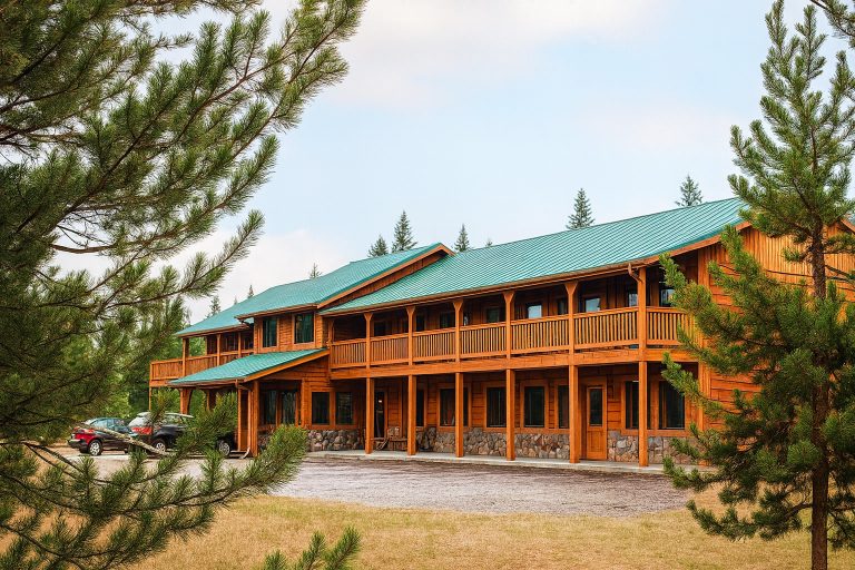
For visitors seeking private vacation rental accommodations near Crystal Lake Trail, Swan River Lodge is located in Condon on 10 private acres along the Swan River. The property provides access to Cold Creek Bridge for swimming and fishing, with the Crystal Lake Trailhead approximately 20 minutes away by vehicle. Direct booking through Swan Valley Stay offers a 15 percent discount compared to third-party booking platforms, reducing lodging costs while providing a convenient base for exploring Mission Mountains trails.
Additional Forest Service campgrounds in the Swan Valley corridor include facilities near Seeley Lake and dispersed camping opportunities throughout national forest lands. Dispersed camping requires knowledge of Leave No Trace principles and current fire restrictions.
Swan Valley accommodations position visitors within easy reach of multiple Mission Mountains trailheads, Holland Lake recreation area, and Bob Marshall Wilderness access points. The area serves as an alternative to crowded lodging markets near Glacier National Park while maintaining proximity to northwest Montana’s premier outdoor recreation.
Trail Conditions and Regulations
Crystal Lake Trail #351 North sees heavy use during summer months. Trail erosion and widening occur in high-traffic areas. Forest Service trail crews perform maintenance periodically, though steep sections remain challenging.
The Mission Mountains Wilderness designation prohibits motorized equipment, mechanized transport including bicycles, and motorized vehicles. Hiking and horseback travel are permitted, though horseback use is prohibited on the Crystal Lake North Trail specifically.
Group size limits apply throughout the Mission Mountains Wilderness. Check current Flathead National Forest regulations for maximum group sizes. Limits help reduce impacts on popular destinations like Crystal Lake.
Dogs are permitted but must be under control. Leashes are recommended in high-use areas and required in some zones. Clean up after dogs and pack out waste.
Campfires may be restricted during high fire danger periods. Check current fire restrictions before trips. Use established fire rings when fires are permitted. Fully extinguish all fires before leaving camp.
Pack out all trash including toilet paper. Wilderness regulations require packing out human waste in some high-use areas. Bury waste at least 6-8 inches deep and 200 feet from water sources when burial is permitted.
Wilderness permits are not currently required for day hiking or overnight camping in the Mission Mountains Wilderness, though this may change. Check with the Flathead National Forest for current permit requirements.
What to Bring
Standard hiking equipment applies for Crystal Lake Trail. A daypack with the Ten Essentials covers basic needs for most summer day hikes: navigation tools, sun protection, insulation, illumination, first aid supplies, fire starter, repair kit, nutrition, hydration, and emergency shelter.
Bear spray is essential. Carry it in a readily accessible location, not buried in a pack. Practice deploying bear spray before hiking in bear country.
Trekking poles significantly reduce stress on knees during the steep descent and especially during the 1,000-foot climb out. Poles improve stability on loose or wet trail sections.
Water filtration or purification equipment is necessary. Crystal Lake and stream water should be treated before drinking. Carry at least 2 liters of water capacity for the 4.6-mile round trip.
Layered clothing accommodates temperature variation between trailhead and lake. Temperatures at the lake may be 10-15 degrees cooler than at the trailhead. Rain gear is advisable during summer months when afternoon thunderstorms develop.
Sturdy hiking boots with ankle support and good traction perform best on the steep, rocky sections. Trail running shoes work for experienced hikers but provide less support on uneven terrain.
Insect repellent helps manage mosquitoes and biting flies near the lake. Peak insect activity occurs June through August.
Fishing equipment for those targeting brook trout should include Montana fishing license, small spinners or flies, and appropriate tackle. Regulations prohibit live bait in many wilderness lakes.
Overnight camping requires additional equipment including tent, sleeping bag rated for cold nights, sleeping pad, cooking equipment, food storage bags or bear canister, and increased water capacity.
Planning Your Hike
Most hikers complete the Crystal Lake Trail round trip in 3-5 hours depending on pace and time spent at the lake. The downhill approach takes 1-1.5 hours for average hikers. The return climb typically requires 1.5-2.5 hours.
Start early to avoid afternoon thunderstorms and secure trailhead parking. Trailhead parking fills by mid-morning on summer weekends.
The return climb gains 1,000 feet over 2.3 miles, averaging 435 feet per mile elevation gain. This compares to popular trails like Mount Sentinel’s M Trail in Missoula. Pace the climb with regular breaks. Carry adequate water for the ascent.
Swimming at the lake requires preparation for cold water temperatures. Even in summer, Crystal Lake water rarely exceeds 60 degrees Fahrenheit. Limit exposure time to prevent hypothermia.
Fishing is typically best during morning and evening hours. Mid-day fishing can be productive in overcast conditions or when insects are hatching.
Photography opportunities include old-growth trees along the trail, the lake with mountain backdrop, waterfalls at the west end, and wildflowers including beargrass during bloom cycles.
Leave No Trace principles are essential given the heavy use Crystal Lake receives. Pack out all trash, minimize campfire impacts, stay on established trails, respect wildlife, and leave what you find.
Check weather forecasts before departure. Mountain weather changes rapidly. Be prepared to turn back if conditions deteriorate.
Inform someone of your hiking plans including expected return time. Cell service is unreliable for emergency communication.
—