Swan Valley, Montana: Interactive 3D Map
The valley is a long trough between two mountain ranges, and the shape of the land explains almost everything: where the trails go, where the lakes sit, and why the drive to Holland Lake takes longer than it looks on a flat map.
So we built an interactive 3D map of Swan Valley, Montana from real elevation data. You can turn it, zoom in on a trailhead, and tap a place to see what’s there and how far it is. Here it is, followed by a guide to what you’re looking at.
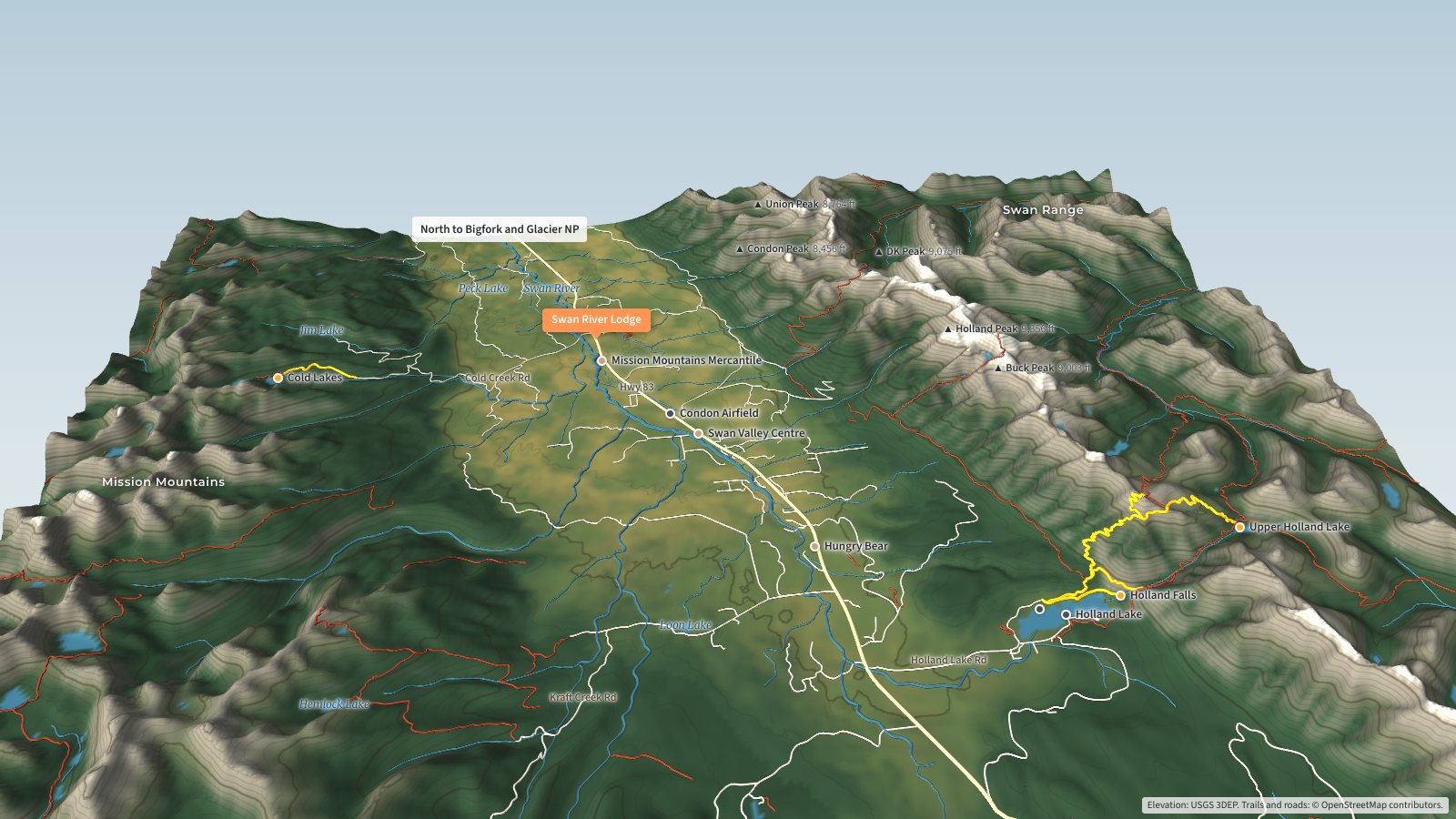
| Area covered | About 24 by 19 miles, from north of Condon to Holland Lake and Clearwater Lake, and from the Mission Mountains crest to the Swan Range crest |
| Elevation | About 3,400 feet on the valley floor to more than 9,000 feet on both ranges |
| On the map | 43 named peaks, 47 named lakes, dozens of hiking trails, the Swan River and its creeks, Hwy 83 and the access roads |
| Data | USGS elevation data, plus trails, roads and place names from OpenStreetMap |
How to Use the Swan Valley 3D Map
Drag to turn the valley. Scroll, or pinch on a phone, to zoom in. The buttons along the top filter the places shown, turn the trail lines and topo lines on and off, and reset the view. The small compass in the corner turns the map back so north is at the top.
Tap a named place, like Holland Falls or the Mercantile, and a card opens with a short description and the straight-line distance from Swan River Lodge, our place just north of Condon. Gold trails are the hikes we’ve written full guides for. Red lines are other trails, blue lines are creeks and the Swan River, and the pale lines are roads. Forest roads appear when you zoom in.
One honest note: the mountains are drawn one and a half times taller than they really are. Without that, a 3D model of a valley this wide looks like a rumpled blanket, and the ridges and drainages are hard to read.
The Lay of the Land: Two Ranges and a River
Swan Valley runs roughly north and south. The Mission Mountains form the west wall, the Swan Range forms the east wall, and the valley floor between them sits around 3,700 feet at Condon. Both ranges climb past 9,000 feet. Holland Peak, at 9,356 feet, is the highest point in the Swan Range and stands almost directly east of Condon. McDonald Peak, the high point of the Mission Mountains at 9,820 feet, sits at the southwest corner of the map.
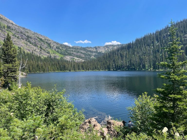
Turn the map so you’re looking north and the pattern is easy to see. The Swan Range rises as one long, steep wall above the east side of the valley. The Missions are more broken up, with side canyons that hold small lakes like Jim Lake and the Cold Lakes. Down the middle, the Swan River collects creeks from both sides and flows north past Condon toward Swan Lake and Flathead Lake.
Holland Lake and the Swan Range Side
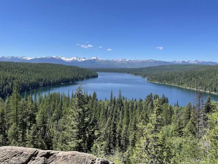
Holland Lake is the best-known spot in the valley, and on the map you can see why. It sits right where the valley floor meets the Swan Range, a 416-acre lake with the mountains coming straight up from its east end. Holland Lake Lodge is on the west end, along with the public beach, the day-use area and a Forest Service campground with 38 sites. Our Holland Lake guide covers all of it in detail.
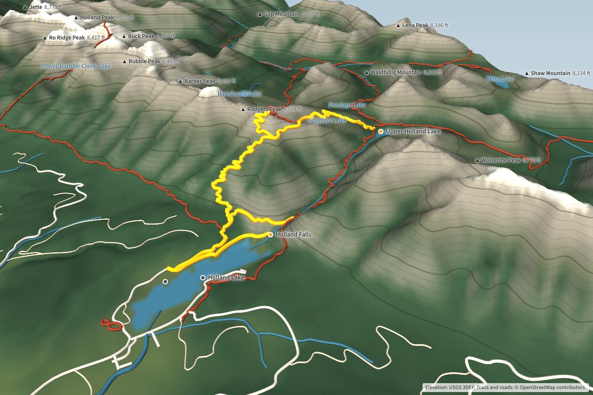
Two of the hikes we get asked about most start here. The Holland Falls trail follows the north shore of the lake to the base of the falls, about 1.6 miles each way with roughly 750 feet of climbing, according to the Forest Service. It’s the most popular hike in the valley for good reason.
Upper Holland Lake is a much bigger day. On the route shown on the map, up the Holland Lookout trail, it’s about 5.4 miles each way with close to 2,400 feet of climbing. Those numbers come from the map data, so treat them as a good estimate and check the trail guide before you go. Zoom in on that part of the map and you’ll see a cluster of small lakes in the basins above, including Sapphire, Pendant and Woodward.
The Mission Mountains Side
West of Hwy 83, the roads climb toward the Mission Mountains Wilderness. Cold Creek Road leads to the Cold Lakes trailhead, about 8.4 miles from the Condon post office. From there the trail to Lower Cold Lake runs about 1.8 miles with roughly 750 feet of climbing, which makes it one of the better short hikes in the valley. Upper Cold Lake sits just beyond it.
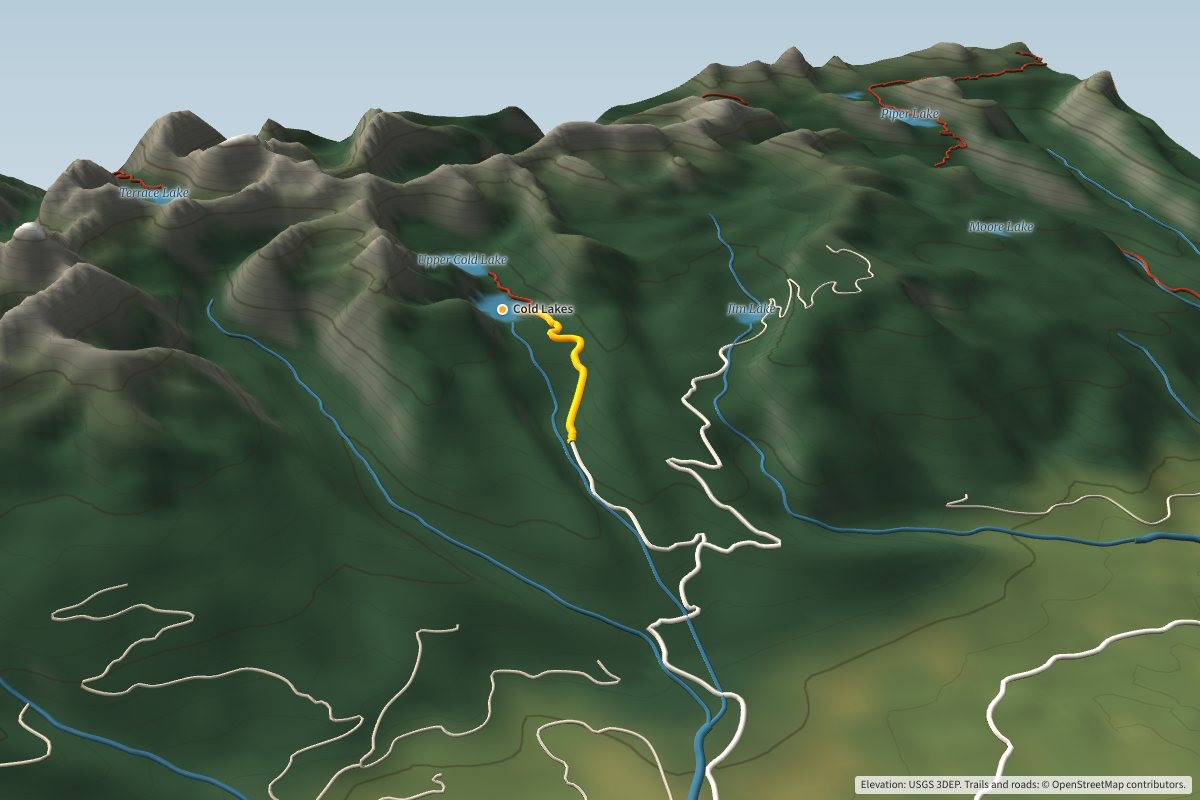
Farther south, Kraft Creek Road heads west to the Glacier Creek and Hemlock Creek trailheads. Glacier Lake, a 104-acre lake at 5,260 feet and one of the easiest hikes into the Missions, sits just past the south edge of our map. There’s no overnight camping at Glacier Lake.
Both sides of the valley are grizzly country. Carry bear spray and know how to use it.
Condon: Supplies, Food and the Airfield
Condon isn’t a town in the usual sense. It’s a stretch of Hwy 83 with a post office, a couple of stores, a community center, a school and a lot of open space in between. The map makes it easier to see how spread out it is.
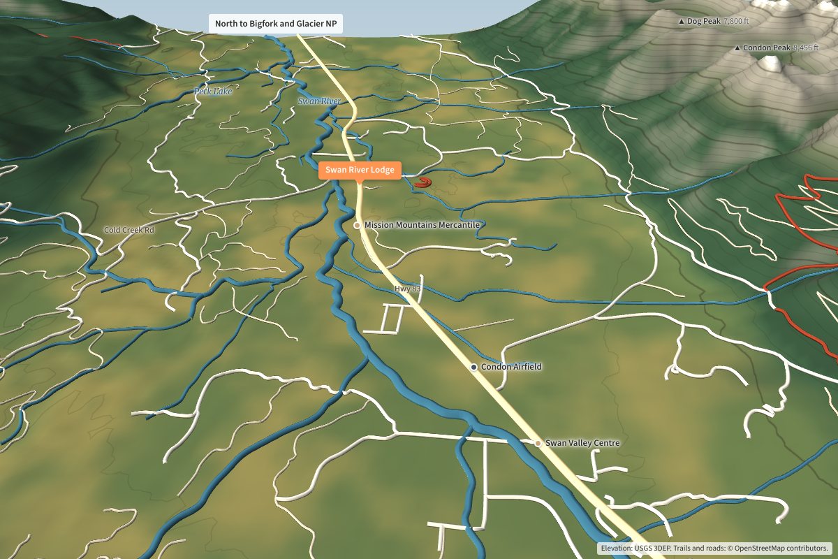
Mission Mountains Mercantile, which everyone calls the Merc, sits next to the post office and is the closest store to Swan River Lodge. It carries a lot, and prices are fair. A few miles south, Swan Valley Centre is a smaller store just south of the airfield, with better fishing gear than the Merc and ice cream cones. The Forest Service information station is across from the airfield.
Hungry Bear is farther south, about 7 miles from the post office. Good pizza and sometimes live music. It has been short-staffed and open Wednesday through Sunday lately, so check before you drive down.
Roads: Hwy 83 and the Access Roads
Hwy 83 runs the full length of the valley. North takes you toward Swan Lake and Bigfork, and Glacier National Park is about 90 minutes away. South takes you to Seeley Lake. Nearly everything else on the map hangs off 83: Holland Lake Road to the east, and Cold Creek Road and Kraft Creek Road to the west.
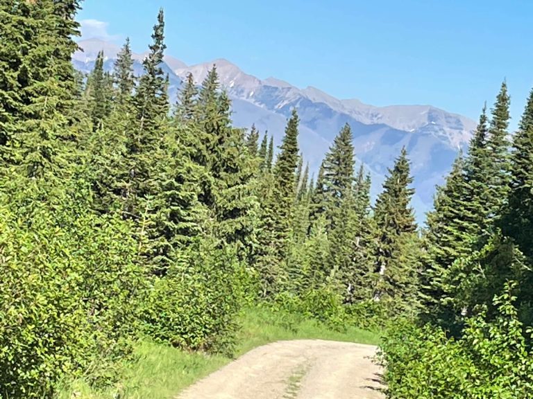
Most of the side roads are gravel, and some forest roads close or go unplowed in winter. If you’re heading to Holland Lake in winter, four-wheel drive is a good idea for the last stretch to the parking area.
Distances from Condon
These are road miles from the Condon post office, measured on the same road data the map uses and rounded. Your odometer may differ a little.
| Destination | Road miles |
|---|---|
| Swan River Lodge | 1.0 |
| Condon Airfield | 2.6 |
| Swan Valley Centre | 3.4 |
| Hungry Bear | 7.3 |
| Cold Lakes trailhead | 8.4 |
| Holland Lake Lodge | 14 |
And the three hikes highlighted on the map:
| Hike | One way | Climbing |
|---|---|---|
| Holland Falls | 1.6 miles | About 750 ft |
| Lower Cold Lake | 1.8 miles | About 750 ft |
| Upper Holland Lake | 5.4 miles | About 2,400 ft |
Where the Map Data Comes From
The terrain is built from the U.S. Geological Survey’s 3D Elevation Program, the national elevation data set, recorded at about 10-meter detail and simplified so the map loads quickly on a phone. The creeks are traced from that elevation data, so a small stream may not sit exactly where it does on the ground.
Trails, roads, lake names and peak names come from OpenStreetMap, a free map built by volunteers. It’s very good here, but it isn’t perfect. Glacier Lake’s trail, for example, isn’t in the data yet.
This map is for planning, not navigation. On the trail, carry a real map or a GPS app with offline maps, and don’t count on cell service once you leave the valley floor.
Frequently Asked Questions
How far is Holland Lake from Condon?
About 14 miles by road from the Condon post office: south on Hwy 83, then east on Holland Lake Road to the lodge and day-use area.
How long is the Holland Falls hike?
About 1.6 miles each way with roughly 750 feet of climbing, according to the Forest Service.
What mountains are on each side of Swan Valley?
The Mission Mountains on the west and the Swan Range on the east. Holland Peak, at 9,356 feet, is the highest point in the Swan Range.
Can you camp at Glacier Lake?
No. Overnight camping isn’t allowed at Glacier Lake. It’s a day hike from the end of Kraft Creek Road.
Can I use this map to navigate on the trail?
No. It’s built for planning. Carry a real map or a GPS app with offline maps when you hike.
More Swan Valley Guides
- Holland Lake, Montana: Complete Visitor’s Guide
- Holland Falls Trail Guide
- Upper Holland Lake Trail Guide
- Things to Do in Swan Valley, Montana
- The History of Swan River Lodge
Heading north to the park? Explore this 3D map of Glacier National Park, with its peaks, glaciers and Going-to-the-Sun Road.